PROVISIONAL DATA SUBJECT TO REVISION
Click to hidestation-specific text
 Rating Information
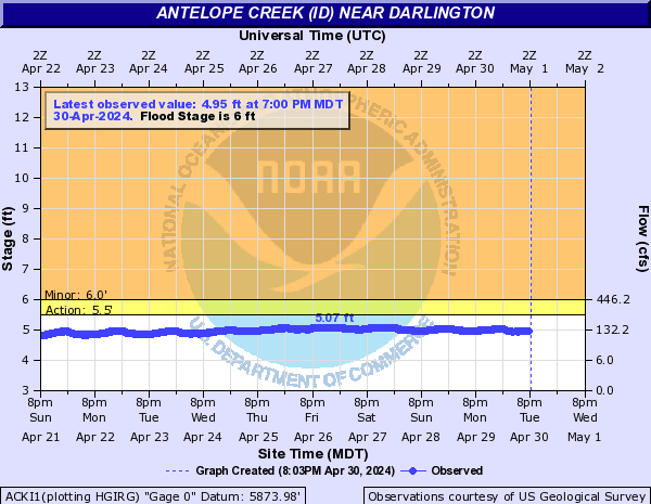
Summary of all available data for this site
Instantaneous-data availability statement

| Min (2021) | 25th percen- tile | Most Recent Instantaneous Value Jul 18 | Median | Mean | 75th percen- tile | Max (2023) |
|---|---|---|---|---|---|---|
| 1.42 | 11 | 14.4 | 31 | 50 | 91 | 125 |

![]() U.S. Department of the Interior |
U.S. Geological Survey
U.S. Department of the Interior |
U.S. Geological Survey
Title: USGS Current Conditions for Idaho
URL:
Page Contact Information: Idaho Water Data Support Team
Page Last Modified: 2025-07-18 21:15:51 EDT
1.94 1.28 nadww02