PROVISIONAL DATA SUBJECT TO REVISION
Click to hidestation-specific text
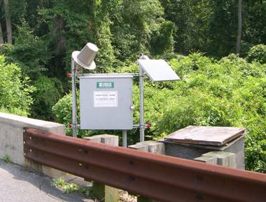
LOCATION.--Lat 38°24'33.6", long 75°12'44.6", Worcester County, MD, Hydrologic Unit 02040303,
   on right bank at downstream side of bridge on U.S. Highway 113, 0.75 mi north of Showell,
   and 1.1 mi upstream from mouth.
DRAINAGE AREA.--6.38 mi2.
PERIOD OF RECORD.--December 1999 to current year.
REVISIONS HISTORY.--WDR-US-2009: 2002-2008.
GAGE.--Water-stage recorder and crest-stage gage. Datum of gage is -0.84 ft above North
   American Vertical Datum of 1988.
REMARKS.--U.S. Geological Survey satellite data-collection platform at station.
EXTREMES FOR PERIOD OF RECORD.--Maximum discharge, 1,370 ft3/s, August 26, 2012,
   gage height, 10.66 ft; minimum discharge, 0.14 ft3/s, Aug. 22-24, 2002.
COOPERATION.--Funding for the operation of this station is provided by the Maryland Department
   of Transportation, and the U.S. Geological Survey.
Summary of all available data for this site
Instantaneous-data availability statement