PROVISIONAL DATA SUBJECT TO REVISION
Click to hidestation-specific text
 LOCATION.--Lat
38°18'14.6", long 76°39'23.6", St. Mary's County,
MD, Hydrologic Unit 02070011, on right bank at downstream side of
bridge on Point Lookout Road (MD-5),
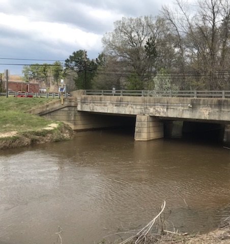
LOCATION.--Lat
38°18'14.6", long 76°39'23.6", St. Mary's County,
MD, Hydrologic Unit 02070011, on right bank at downstream side of
bridge on Point Lookout Road (MD-5),approximately 0.9 mi northwest of Leonardtown, 0.2 mi above confluence with Nelson Run, and 1.6 mi upstream from confluence with Breton Bay.
DRAINAGE AREA.--29.6 mi2.
PERIOD OF RECORD.--April 2021 to current year.
GAGE.--Water-stage recorder, crest-stage gage, and tipping-bucket precipitation gage. Datum of gage is 0.00 feet above North American Vertical Datum of 1988.
REMARKS.--This is a stage-only station. Discharge is not determined at this location. U.S. Geological Survey satellite data-collection
platform at station.
COOPERATION.--Funding for the operation of this station is provided by the St. Mary's County Department of Emergency Management.
| Boating safety tips |
Summary of all available data for this site
Instantaneous-data availability statement
