PROVISIONAL DATA SUBJECT TO REVISION
Click to hidestation-specific text
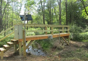 |
LOCATION.-- Lat 39°30'25.5", long 79°15'06.0", Garrett County, MD, Hydrologic Unit 05020006, on right bank,
   250 ft downstream from confluence with unnamed tributary, 4.5 mi northwest of Swanton, and 0.5 mi upstream
   from confluence with Deep Creek Lake.
DRAINAGE AREA.--3.53 mi2, from automated delineation using 30-meter National Elevation Dataset, digital
   elevation model data, dated February 2011.
PERIOD OF RECORD.--August 2016 to current year.
GAGE.--Water-stage recorder and crest-stage gage. Datum of gage is 2,460.41 ft above North American
   Vertical Datum of 1988.
REMARKS.--U.S. Geological Survey satellite data-collection platform at station.
EXTREMES FOR PERIOD OF RECORD.--Maximum discharge, 228 ft³/s, Feb. 28, 2021, gage height, 6.23 ft;
   minimum discharge, 0.06 ft³/s, Sept. 21-23, 25, 26, 2016. Maximum daily precipitation, 3.84 in., Sept. 1, 2021.
COOPERATION.--Funding for the operation of this station is provided by the Maryland Department of Natural
   Resources and the U.S. Geological Survey.
Summary of all available data for this site
Instantaneous-data availability statement
