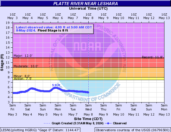
PROVISIONAL DATA SUBJECT TO REVISION
Click to hidestation-specific text
| Funding for this site is provided by | ||
|
|
 |
|
| Lincoln Water System | Metropolitan Utilities District | Cooperative Water Program |
 WaterNow – get the latest
gage data from your mobile phone or email.
WaterNow – get the latest
gage data from your mobile phone or email.

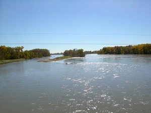
Downstream view from USGS gaging station: Platte River near Leshara, Nebr.
|
|
Platte
River Basin (Loup River-Elkhorn River) |
|
Summary of all available data for this site
Instantaneous-data availability statement

![Graph of Discharge, cubic feet per second, [Discharge from Primary Sensor]](https://nadww01.er.usgs.gov/nwisweb/data/img/USGS.06796500.94648.00060..20250708.20250715.log.0.p50.gif)
![Graph of Gage height, feet, [Primary Stage Sensor]](https://nadww01.er.usgs.gov/nwisweb/data/img/USGS.06796500.94647.00065..20250708.20250715..0..gif)


