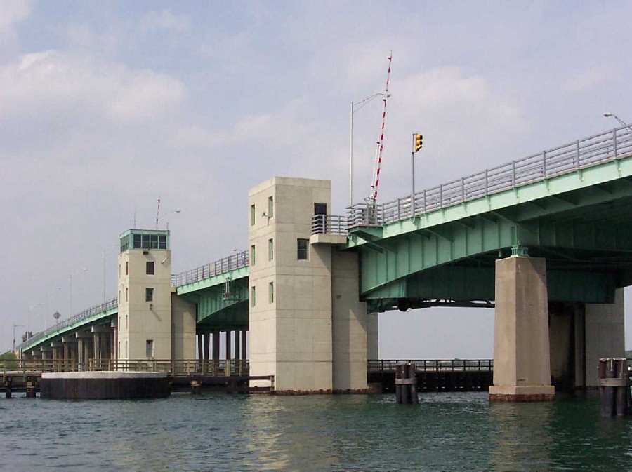
LOCATION.--Lat 40°35'35", long
73°44'16" referenced to North American Datum of 1927,
Nassau County, NY, Hydrologic Unit 02030202, at Nassau County
Bridge Authority Atlantic Beach Bridge, in Atlantic
Beach.
PERIOD OF RECORD.--August 2002 to current year. November
1972 to October 1998, in files of Town of Hempstead Department
of Conservation & Waterways.
GAGE.--Water-stage recorder. Datum of gage is NGVD of
1929. November 1972 to September 1989, water-stage recorder at
site 900 ft west. October 1990 to October 1998, water-stage
recorder at site 300 ft south.
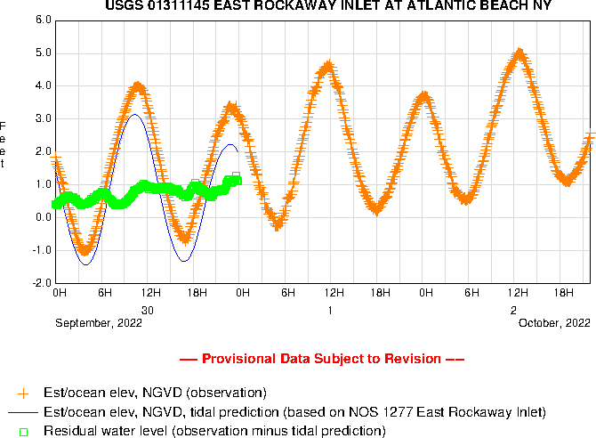
REMARKS.--ELEVATION WY 2013: Records excellent, except
those for Feb. 6-17, 20, Feb. 22 to Mar. 20, Mar. 22 to June 13
and July 24-25, which are good. Periods of missing record were
estimated with MISTE using a linear regression with 01311850
and 01311143. Satellite and telephone elevation telemeters at
station.
EXTREMES FOR PERIOD OF RECORD.--Maximum elevation, 10.80
ft, Oct. 29, 2012; minimum elevation, -4.77 ft, Mar. 9,
2005.
EXTREMES OUTSIDE PERIOD OF RECORD.--Storm tides of Oct.
31, 1991, and Dec. 11, 1992, reached elevations of 6.7 and 7.7
ft, respectively, from information provided by Town of
Hempstead Department of Conservation & Waterways. Minimum
elevation recorded, -5.0 ft, Jan. 10, 1978, from information
provided by Town of Hempstead Department of Conservation &
Waterways.
 Site Information
 WaterAlert – get an
email or text (SMS) alert based on your chosen threshold.
WaterAlert – get an
email or text (SMS) alert based on your chosen threshold.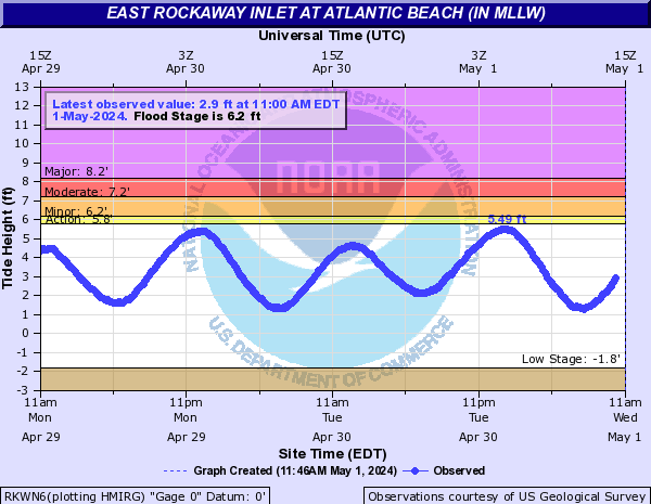
 Station image