Funding for this site is provided by:
 STATION.
--01480638 BROAD RUN AT NORTHBROOK, PA
LOCATION.--Lat 39`55'49", long
75`41'06", Chester County, Hydrologic Unit 02040205, on right
bank 50 ft upstream from Northbrook Road and 2.2 mi south of
Marshallton.
DRAINAGE AREA.--6.39 square miles.
PERIOD OF RECORD.--December 2002 to April 2004;
October 2004 to current year.
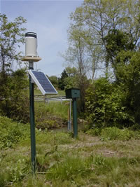
GAGE.--Water-stage recorder, crest-stage gage, and
Pluvio precipitation gage. Precipitation gage removed November 29,
2021. Elevation of gage is 190.78 ft above NAVD of 1988. Satellite
telemetry at station.
COOPERATION.--Sation established and maintained by the
U.S. Geological Survey. Funding for the operation of this station is
provided by the Chester County Water Resources Authority and the U.S.
Geological Survey.
