Funding for this site is provided by:
 STATION.
--01480685 MARSH CREEK NEAR DOWNINGTOWN,
PA
LOCATION.--Lat 40`03'19", long
75`43'00", Chester County, Hydrologic Unit 02040205, on left
bank 1,000 ft downstream from Marsh Creek Dam, 0.2 mi upstream from
mouth, and 3.0 mi north of Downingtown.
DRAINAGE AREA.--20.3 square miles.
PERIOD OF RECORD.--June 1973 to current year.
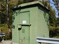
GAGE.--Water-stage recorder, crest-stage gage, and
concrete control. Elevation of gage is 284.8 ft. above North American
Vertical Datum of 1988 (GNSS survey). Prior to February 19, 2025, the
datum of gage was erroneously reported as 280 ft above National
Geodetic Vertical Datum of 1929. Satellite telemetry at station.
REMARKS.--Flow completely regulated since November
1973 by Marsh Creek Reservoir.
COOPERATION.--Funding for the operation of this
station is provided by the Pennsylvania Department of Environmental
Protection and the U.S. Geological Survey.
GAGE HEIGHTS OF IMPORTANCE.-
Supplied by USGS: Data Transmitter Operational Limit -
10.1 ft
