Warning: Javascript must be enabled to use all the features on this page!


Page Loading - Please Wait...

* We've detected you're using a mobile device. Find our Next Generation Station Page here.
Click to hideNews Bulletins

USGS 01484690 UNNAMED DTCH ON FRED HUDSON RD AT BETHANY BCH, DE

PROVISIONAL DATA SUBJECT TO REVISION

Click to hidestation-specific text

LOCATION.--Lat 38°33'19.6", long 75°03'48.4", Sussex County, DE, Hydrologic Unit 02040303, 
   at south side of Fred Hudson Road, 600 ft north of Salt Pond and 1.1 mi north of Bethany Beach.
PERIOD OF RECORD.--May 2015 to current year.
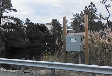
GAGE.--Water-stage recorder. Datum of gage is 0.00 ft. above North American Vertical Datum of 1988.  
REMARKS.--This is a tidal station. Discharge is not determined at this location. U.S. Geological 
   Survey satellite data-collection platform at station.
EXTREMES FOR PERIOD OF RECORD.--Maximum elevation, 2.78 ft, Jan. 23, 2016;
   minimum elevation, -1.71 ft, Jan. 7, 2018.
COOPERATION.--Funding for the operation of this station is provided by the Delaware Department of
   Transportation.
This station managed by the MD-DE-DC Water Science Center Dover office.

Available Parameters Period of Record
  
2015-05-12  2024-04-19


 (365)
 

  -- or --


Summary of all available data for this site
Instantaneous-data availability statement


Estuary or ocean water surface elevation above NAVD 1988, feet


Graph of DAILY Estuary or ocean water surface elevation above NAVD 1988, feet

Add up to 2 more sites and replot for "Estuary or ocean water surface elevation above NAVD 1988, feet"

?


Create presentation-quality graph.