PROVISIONAL DATA SUBJECT TO REVISION
Click to hidestation-specific text
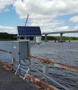
LOCATION.--Lat 38°32'38.3", long 75°43'12.5", Wicomico County, MD, Hydrologic Unit 02080109,
   on left bank at upstream side of fishing pier (remains of old State highway 313 bridge),
   at Sharptown.
DRAINAGE AREA.--Not determined.
PERIOD OF RECORD.--May 1991 to September 1995. December 2004 to current year.
GAGE.-- Water-stage recorder. Datum of gage is 0.00 ft above North American Vertical Datum of 1988.
   Prior to October 1, 2013, datum of gage 0.00 ft above National Geodetic Vertical Datum of 1929, 0.81 ft higher.
REMARKS.--This is a tidal station. Discharge is not determined at this location.
   U.S. Geological Survey satellite data-collection platform at station.
EXTREMES FOR PERIOD OF RECORD.--Maximum elevation, 5.59 ft, at datum then in use, Oct. 30, 2012;
   minimum elevation, -4.40 ft, at current datum, March 3, 2018.
COOPERATION.--Funding for the operation of this station is provided by the Delaware Emergency
   Management Agency through the Delaware Geological Survey.
Summary of all available data for this site
Instantaneous-data availability statement
