LOCATION.--Lat 42°23'38.8", long
77°43'08.4" referenced to North American Datum of
1983, Steuben County, NY, Hydrologic Unit 02050104, 1,000 ft
upstream from Arkport Dam, 1.3 mi west of Arkport, and 2.3 mi
upstream from small tributary.
DRAINAGE AREA.--30.5 mi².
PERIOD OF RECORD.--January 1951 to September 1960 (daily
elevations at 1200 and month-end contents), October 1960 to
September 1968 (daily elevations at 2400 and month-end
contents), October 1968 to September 1985 (daily mean
elevations and month-end contents), October 1985 to May 1991
(month-end elevations and contents), October 2011 to current
year (daily mean elevations). Month-end elevations and contents
not published June 1991 to September 2011; records for this
period are available in the files of the U.S. Geological
Survey.
REVISIONS HISTORY.--WSP 1552: 1951-57. WRD NY 1974:
1973. Selected-value daily elevations and mean daily
elevations for the period January 1951 to September 2011 were
edited for timestamp and database publication errors on Feb. 5,
2025.
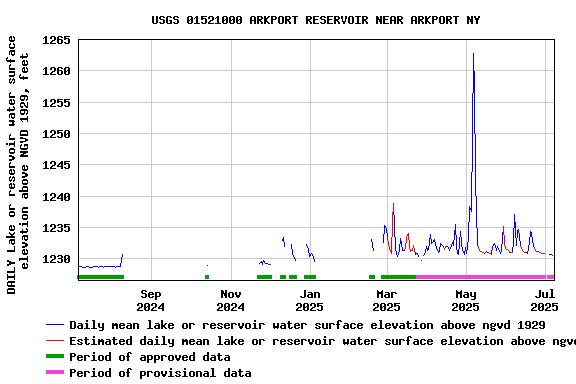
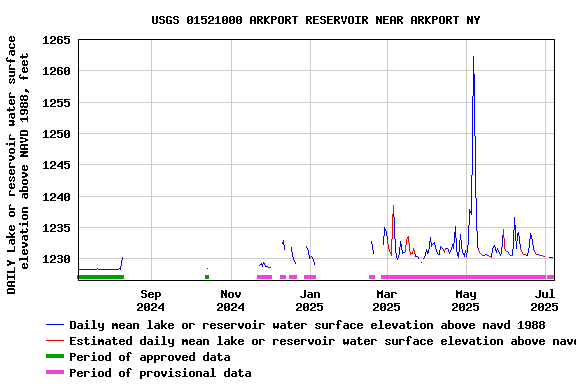
GAGE.--Water-stage recorder. Reservoir elevation record
is provided in NGVD of 1929 and NAVD of 1988 datums. To convert
NGVD of 1929 elevations to NAVD of 1988, subtract 0.43
ft.
REMARKS.--Reservoir is formed by earthfill dam with
concrete spillway, completed by Corps of Engineers in 1940 for
flood control; first used for flood regulation on Mar. 31,
1940. Initial usable capacity, 7,936 acre-ft between elevations
1,218.0 ft (sill of conduit) and 1,304.0 ft (crest of
spillway). No dead storage. The flood control works consist of
a pressure conduit and a side-channel spillway and are not
provided with gates. Water is stored during high flows and
released gradually. Reservoir contents unknown since 1992 as a
result of periodic dredging. Prior to October 2011, minimum
recordable elevation, about 1,227.7 ft; elevation record
published below this elevation should not be interpreted as
representative of the reservoir water surface elevation. From
October 2011 to current year, minimum recordable elevation,
1,227.41 ft.
EXTREMES FOR PERIOD OF RECORD.--Maximum elevation,
1,304.04 ft above NGVD of 1929 (1,303.61 ft above NAVD of
1988), June 23, 1972, contents, 7,944 acre-ft; minimum
elevation and contents not determined.
 Site Information
 WaterAlert – get an
email or text (SMS) alert based on your chosen threshold.
WaterAlert – get an
email or text (SMS) alert based on your chosen threshold.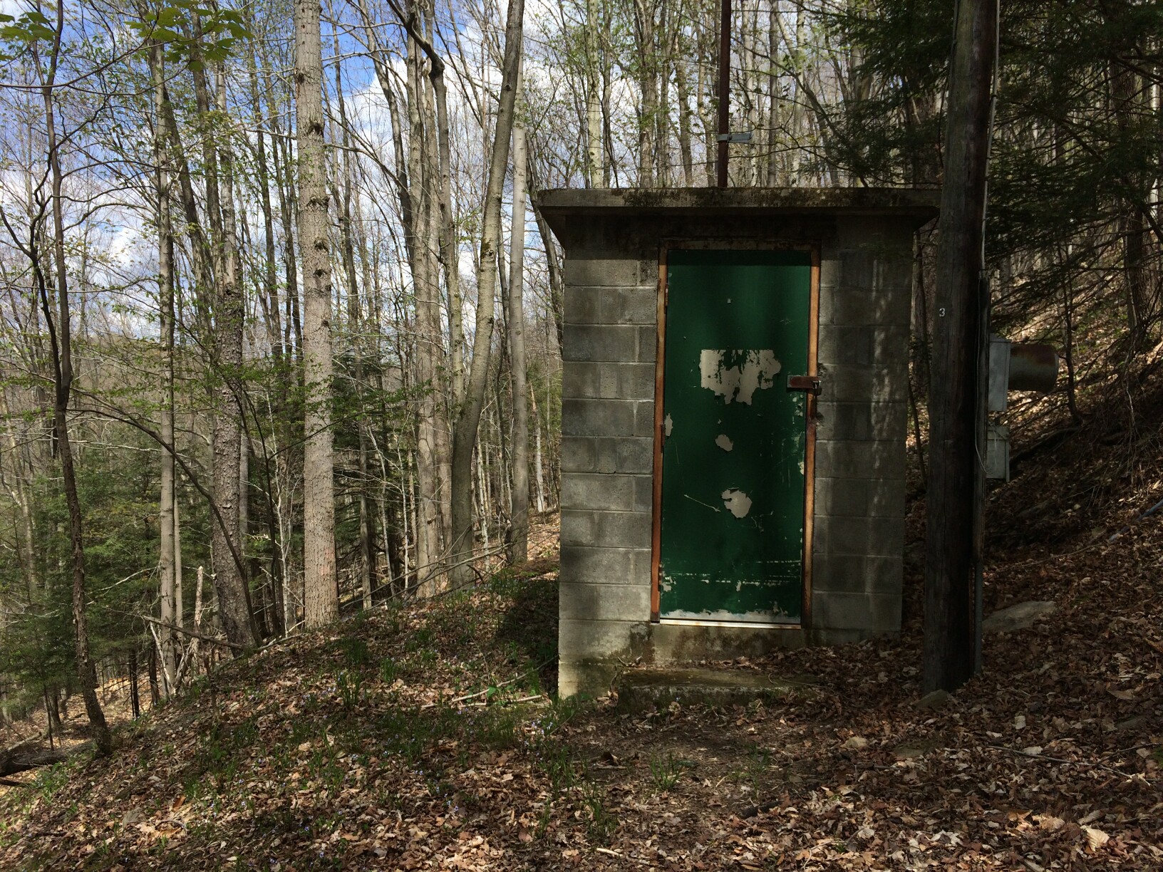 Station image