Funding for this site is provided by:
 STATION.
--01531250 NB SUGAR CREEK TRIBUTARY NEAR
COLUMBIA CROSS ROADS, PA
LOCATION.--Lat 41`50'25", long
76`49'38", Bradford County, Hydrologic Unit 02050106, at
single-span concrete bridge on secondary road, 1.4 mi upstream from
mouth and 1.5 mi west of Columbia Cross Roads.
DRAINAGE AREA.--8.83 square miles.
PERIOD OF RECORD.--September 1962 to September 1968;
October 1968 to March 1981(partial record); May 2010 to current
year.
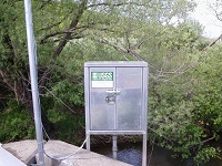
GAGE.--Water-stage recorder and crest-stage gage.
Datum of gage is 1,136.09 ft above North American Vertical Datum of
1988 (from benchmark). Prior to May 13, 2010 water-stage recorder at
datum 1.0 ft higher. Prior to November 4, 2024, the datum of gage was
reported as 1,136.56 ft above National Geodetic Vertical Datum of 1929.
Satellite telemetry at station.
COOPERATION.--Station established and maintained by
the U.S. Geological Survey. Funding for the operation of this station
is provided by Repsol Oil & Gas USA.
