Warning: Javascript must be enabled to use all the features on this page!


Page Loading - Please Wait...

Click to hideNews Bulletins
! This page is undergoing modernization and will be decommissioned in the future. Daily data are now available in WDFN.
Try it out and tell us what you think at wdfn@usgs.gov

USGS 01538960 Huntington Creek at Jonestown, PA

PROVISIONAL DATA SUBJECT TO REVISION

Click to hidestation-specific text

Station gage imageSTATION.--01538960 Huntington Creek at Jonestown, PA
LOCATION.--Lat 41`07'43.5", long 76`18'12.5", referenced to North American Datum of 1983, Columbia County, Hydrologic Unit 02050107.
DRAINAGE AREA.--106 square miles.
PERIOD OF RECORD.--May 2020 to current year.
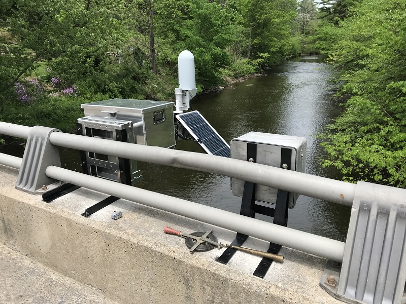
GAGE.--Water-stage recorder. Datum of gage is 674.8 ft above North American Vertical Datum of 1988 (NAVD88) from GNSS survey. Prior to June 5, 2025, the datum of gage was erroneously reported 676 or 677 ft above NAVD88 depending on source. Satellite and iridium telemetry at station.
COOPERATION.--Station established and maintained by the U.S. Geological Survey. Funding for the operation of this gage is provided by Columbia County, PA.
This station managed by the PAWSC Williamsport Field Office.

Available Parameters Period of Record
  
2020-05-28  2025-07-15


 (365)
 

  -- or --


Summary of all available data for this site
Instantaneous-data availability statement


Gage height, feet


Graph of DAILY Gage height, feet

Add up to 2 more sites and replot for "Gage height, feet"

?


Create presentation-quality graph.