LOCATION.--Lat 38°19'59.9", long 76°43'30.0", St. Marys County, MD, Hydrologic Unit 02070011,
on left bank 60 ft downstream from bridge on State Highway 242, 0.5 mi north of Clements, 2.3 mi
upstream from mouth, and 5.7 mi northwest of Leonardtown.
DRAINAGE AREA.--18.5 mi2.
PERIOD OF RECORD.--October 1968 to September 2005, October 2006 to current year. Prior to September
20, 2019, published as ST CLEMENT CREEK NEAR CLEMENTS, MD.
REVISIONS HISTORY.--WDR-US-2009: 2000-2005, 2007, 2008.
https://waterdata.usgs.gov/nwis/uv/?site_no=0661050: 2020.
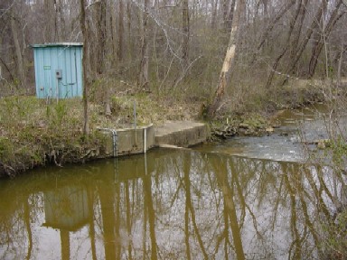
GAGE.--Water-stage recorder, crest-stage gage, and concrete control. Datum of gage is 5.45 ft above
North American Vertical Datum of 1988.
REMARKS.--Occasional regulation from unknown source upstream from station. U.S. Geological Survey
satellite data-collection platform at station.
EXTREMES FOR PERIOD OF RECORD.--Maximum discharge, 8,620 ft3/s, Aug. 4, 2020, gage height, 9.08 ft;
minimum discharge, no flow at times in 1977, 1980, 1981, 1983, 1985-89, 1991, 1993, 1995, 1999,
2002, 2003, 2005, 2007, 2008, 2010, 2012, and 2016.
COOPERATION.--Funding for the operation of this station is provided by the Maryland Geological
Survey, and the U.S. Geological Survey.
