Warning: Javascript must be enabled to use all the features on this page!
Page Loading - Please Wait...
Click to hideNews Bulletins
Explore the NEWUSGS National Water Dashboard interactive map to access real-time water data from over 13,500 stations nationwide.
This page is undergoing modernization and will be decommissioned in the future.
Daily data are now available in WDFN.
Try it out and tell us what you think at wdfn@usgs.gov
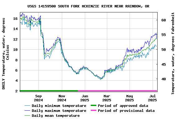
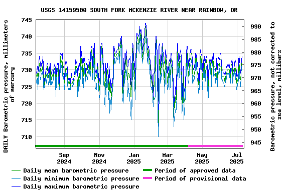
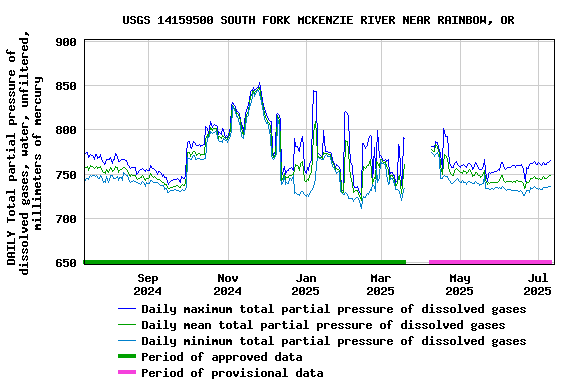
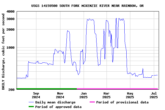
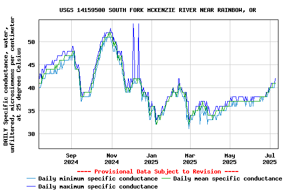
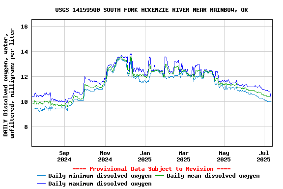
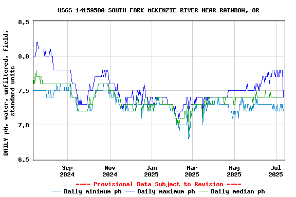
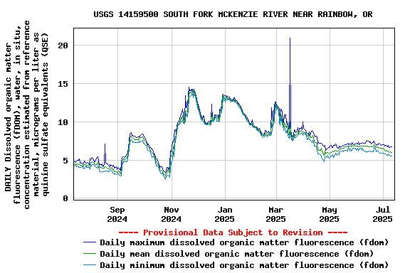
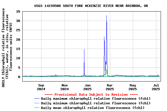
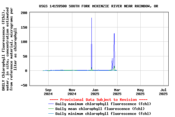
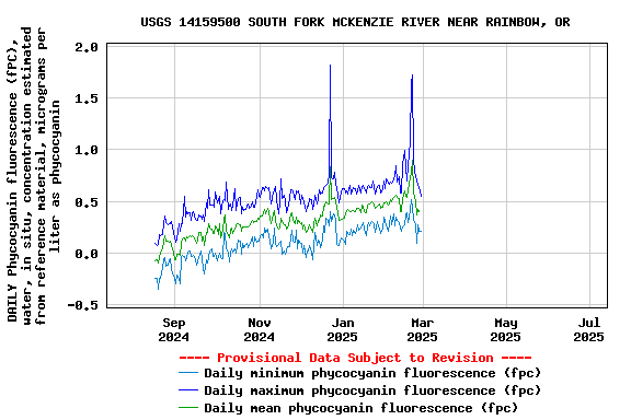
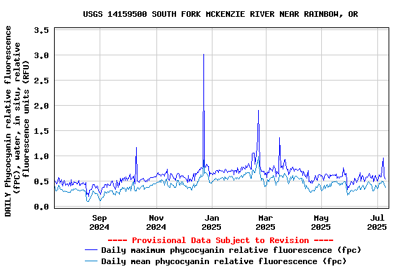
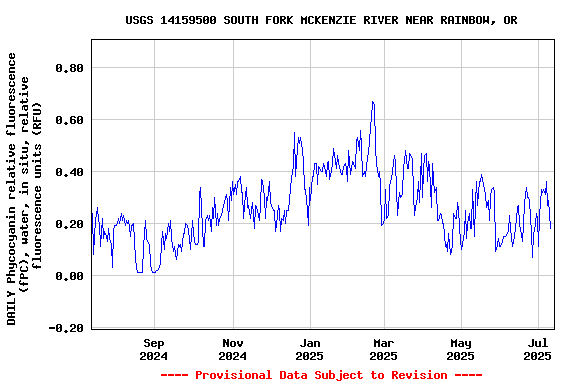
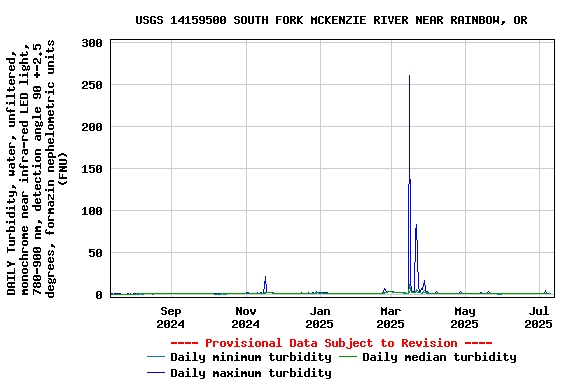
USGS 14159500 SOUTH FORK MCKENZIE RIVER NEAR RAINBOW, OR
Station operated in cooperation with the U.S. Army Corps of
Engineers.
NOTE: The most current shifted rating for this site can be found at USGS Rating Depot website.NOTE: Specific Gage Analysis and Discharge Measurement Cross Sections can be found here.