 LOCATION.--Lat
38°43'33", long 76°39'47", Hydrologic Unit 02060006,
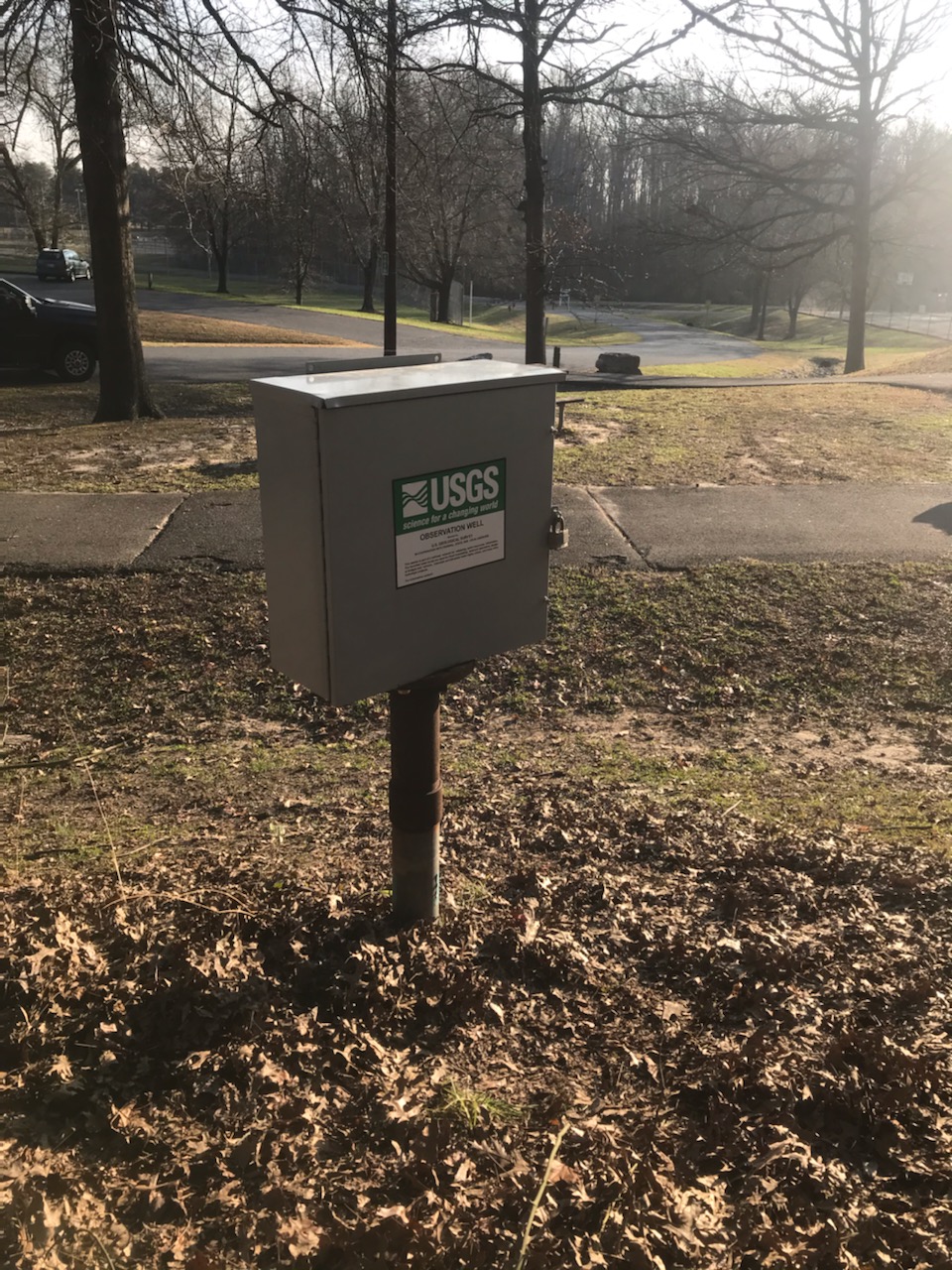
at Dunkirk Regional Park, Dunkirk.
LOCATION.--Lat
38°43'33", long 76°39'47", Hydrologic Unit 02060006,
at Dunkirk Regional Park, Dunkirk.
WELL CHARACTERISTICS.--Depth 320 ft. Upper casing diameter 4 in;
top of first opening 310 ft, bottom of last opening 320 ft. Drilled,
observation, artesian well.
GAGE.--Water-level measurements by U.S. Geological Survey
personnel. Equipped with digital water-level recorder, Feb. 9, 2004 to
current year. U.S. Geological Survey water-level telemeter at
well.
DATUM.--Land-surface datum is 137.87 ft above National Geodetic
Vertical Datum of 1929. Measuring point: Top of 4 in casing, 2.97 ft
above land-surface datum, Oct. 19, 2005, to present.
REMARKS.--Maryland Groundwater-Level Monitoring Network
observation well. Water levels are affected by regional groundwater
withdrawal.
PERIOD OF RECORD.--August 1979 to current year.
EXTREMES FOR PERIOD OF RECORD.--Highest water level measured,
4.05 ft above sea level (133.82 ft below land surface), May 6, 1980;
lowest measured, 49.19 ft below sea level (187.06 ft below land
surface), Aug. 18, 19, 2007 (recorder).
COOPERATION.--Funding for the operation of this station is
provided by the Calvert County Department of Public Works, the Maryland
Geological Survey and the U. S. Geological Survey.
Notice:
Water-level values for this site are now being published using the
datum reference feet below land surface.
In order to convert the published values to a level in feet related to
sea level, subtract the land surface values from the altitude of land
surface, 137.87 (ft NGVD29).
The hydrograph below displays both feet below land surface and sea
level scales on the dual Y-axes.
This station managed by the MD-DE-DC Water Science Center Baltimore office.
Summary of all available data for this site
Instantaneous-data availability statement
