Warning: Javascript must be enabled to use all the features on this page!


Page Loading - Please Wait...

Click to hideNews Bulletins

USGS 393126076244301 RAIN GAGE IN WINTERS RUN BASIN AT FALLSTON, MD

PROVISIONAL DATA SUBJECT TO REVISION

Click to hidestation-specific text

LOCATION.--Lat 39°31'26.2", long 76°24'43.2", Harford County, MD, Hydrologic Unit
   02060003, southeast of Fallston Volunteer Fire and Ambulance Company, Carrs 
   Mill Road, and 0.7 mi north of Fallston.
PERIOD OF RECORD.--December 2003 to current year.
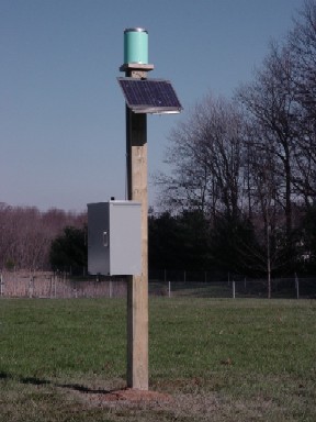
GAGE.--Tipping-bucket rain gage. Elevation of gage is 451 ft above North American
   Verical Datum of 1988 from digital elevation model.
REMARKS.--U.S. Geological Survey water-data telemeter at station.
EXTREMES FOR PERIOD OF RECORD.--Maximum daily precipitation, 8.90 in, September 30, 2010.
COOPERATION.--Funding for the operation of this station is provided by the Harford County
  Department of Public Works.
This station managed by the MD-DE-DC Water Science Center Baltimore office.

Available Parameters Period of Record
  
2003-12-01  2024-04-25


 (365)
 

  -- or --


Summary of all available data for this site
Instantaneous-data availability statement


Precipitation, total, inches


Graph of DAILY Precipitation, total, inches

Add up to 2 more sites and replot for "Precipitation, total, inches"

?


Create presentation-quality graph.