PROVISIONAL DATA SUBJECT TO REVISION
Click to hidestation-specific text
 STATION.--01549700 PINE CREEK BELOW LITTLE PINE
CREEK NEAR WATERVILLE, PA
STATION.--01549700 PINE CREEK BELOW LITTLE PINE
CREEK NEAR WATERVILLE, PA LOCATION.--Lat 41`16'25", long 77`19'28", Lycoming County, Hydrologic Unit 02050205, on left bank on State Highway 44, on abutment of abandoned bridge 0.9 mi downstream from Ramsey Run, 4.0 mi downstream from Little Pine Creek, 4.0 mi south of Waterville, and 9.2 mi upstream from mouth.
DRAINAGE AREA.--944 square miles.
PERIOD OF RECORD.--October 1957 to current year.
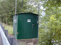
GAGE.--Water-stage recorder, crest-stage gage, and water-quality monitor. Datum of gage is 569.98 ft above North American Vertical Datum of 1988 (from benchmark). Prior to June 16, 1982, non-recording gage at same site and datum. Prior to June 5, 2025, the datum of gage was reported as 570.62 ft above National Geodetic Vertical Datum of 1929. Satellite and landline telemetry at station.
COOPERATION.--Station established and maintained by the U.S. Geological Survey. Funding for the operation of this station is provided by the Pennsylvania Department of Environmental Protection and the U.S. Geological Survey.
Summary of all available data for this site
Instantaneous-data availability statement


