USGS 09037500 WILLIAMS FORK NEAR PARSHALL, CO

PROVISIONAL DATA SUBJECT TO REVISION

Click to hidestation-specific text
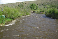
Click for larger image

Station operated by the U.S. Geological Survey, Colorado Water Science Center, as part of the USGS National Streamflow Information Program (NSIP).

Current shift adjusted rating table.
What is a shift adjusted stage-discharge rating table?

Boating safety tips

This station managed by the Lakewood Field Office.

Available Parameters Available Period
  
2021-04-30  2024-10-01
1992-04-04  2024-11-27
2020-11-23  2024-11-27
2021-04-30  2024-10-01
2021-04-30  2024-10-01
2021-04-30  2024-10-01
2021-04-30  2024-10-01


 (7)
 

  -- or --


Summary of all available data for this site
Instantaneous-data availability statement
*** There are no data available on the Waterdata system for the time period specified,
    although data may be available in the files of the local USGS office operating the station.