PROVISIONAL DATA SUBJECT TO REVISION
Click to hidestation-specific text
Due to the upcoming removal of the US Army Corps of Engineers (USACE) Elizabeth Lock and Dam, discharge will no longer be reported for this station after July 8, 2024. Any questions concerning this parameter should be forwarded to the USACE Pittsburgh. https://www.lrd.usace.army.mil/Media/News/Article/3760013/pittsburgh-district-to-demolish-dam-in-monongahela-river-after-more-than-100-ye/
 STATION.--03075070 MONONGAHELA RIVER AT ELIZABETH,
PA
STATION.--03075070 MONONGAHELA RIVER AT ELIZABETH,
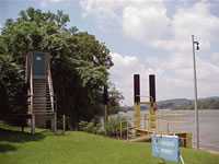
PALOCATION.--Lat 40`15'44", long 79`54'05", Allegheny County, Hydrologic Unit 05020005, on right bank 30 ft landward from upstream end of guide wall, 1,050 ft upstream from dam at lock 3 at Elizabeth, 0.4 mi downstream from Lobbs Creek, and at mile 24.0.
DRAINAGE AREA.--5,340 square miles.
PERIOD OF RECORD.--October 1933 to current year.
GAGE.--Water-stage recorder and concrete dam control. Datum of gage is 717.34 ft above North American Vertical Datum on 1988 (from benchmark). From Oct. 1, 1967 to Sept. 30, 1976, at site 17.5 mi upstream at datum 15.70 ft higher. Prior to Oct. 1, 1967, water-stage recorder at site 17.9 mi upstream at datum 17.43 ft higher. Oct. 1, 1965 to Sept. 30, 1967, auxiliary staff gage, Apr. 14, 1966 to Sept. 30, 1967, auxiliary water-stage recorder and Oct. 1, 1967 to Nov. 4, 1990, water-stage recorder at present site at datum 7.60 ft higher. Prior to February 20, 2024, the datum of gage was reported as 717.90 ft above National Geodetic Vertical Datum of 1929. Satellite telemetry at station.
COOPERATION.--Station established and maintained by the U.S. Geological Survey. Funding for the operation of this station is provided by the U.S. Army Corps of Engineers, Pittsburgh District, the Pennsylvania Department of Environmental Protection, and the U.S. Geological Survey.
REMARKS.--Flow regulated by locks above station, since 1938 by Tygart Lake, and since 1926 by Lake Lynn, combined capacity, 357,000 acre-ft.
GAGE HEIGHTS OF IMPORTANCE.-
Supplied by NWS: Action stage-16.5 ft; Flood stage-20 ft; Moderate flood stage-23 ft; Major flood stage-26 ft.
Summary of all available data for this site
Instantaneous-data availability statement