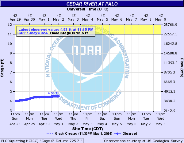
PROVISIONAL DATA SUBJECT TO REVISION
Click to hidestation-specific text
 Site Information
Summary of all available data for this site
Instantaneous-data availability statement
Temperature, water, degrees Celsius |
||
|
||


![]() U.S. Department of the Interior |
U.S. Geological Survey
U.S. Department of the Interior |
U.S. Geological Survey
Title: USGS Current Conditions for the Nation
URL:
Page Contact Information: Iowa Water Data Support Team
Page Last Modified: 2025-07-06 07:41:16 EDT
4.09 2.09 nadww02