PROVISIONAL DATA SUBJECT TO REVISION
Click to hidestation-specific text
Funding for this site is provided by:
 STATION.--401843078075401 HUNTINGDON COUNTY, local
well number HU301
STATION.--401843078075401 HUNTINGDON COUNTY, local
well number HU301LOCATION.--Lat 40`18'44", long 78`07'53", Hydrologic Unit 02050303, at Trough Creek State Park, and near Newburg.
OWNER.--U.S. Geological Survey.
AQUIFER.--Pocono Formation, Early Mississippian age.
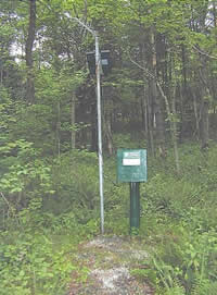
WELL CHARACTERISTICS.--Drilled observation well, diameter 6 in., depth 105 ft, cased to 18 ft, open hole.
INSTRUMENTATION.--Data collection platform with 15-minute recording interval since April 2023; prior, 60-minute recording interval. Satellite telemetry at station.
DATUM.--Elevation of land surface is 973 ft above North American Vertical Datum of 1988, from Lidar. Measuring point: Top of casing, 3.63 ft above land-surface datum.
REMARKS.--Daily maximum, minimum, and mean water levels since October 1994 are available from the District Office.
PERIOD OF RECORD.--August 1969 to current year.
COOPERATION.--Funding for the operation of this station is provided by the Pennsylvania Department of Environmental Protection and the U.S. Geological Survey.
Summary of all available data for this site
Instantaneous-data availability statement