PROVISIONAL DATA SUBJECT TO REVISION
Click to hidestation-specific text
Funding for this site is provided by:
 STATION.--404556077525101 CENTRE COUNTY, local well
number CE 686.
STATION.--404556077525101 CENTRE COUNTY, local well
number CE 686.LOCATION.--Lat 40`45'56.3", long 77`52'50.5", Hydrologic Unit 02050302 at State College.
OWNER.--Privately owned.
WELL CHARACTERISTICS.--Drilled observation well, diameter 6 in., depth 345 ft, cased to 84 ft, open hole.
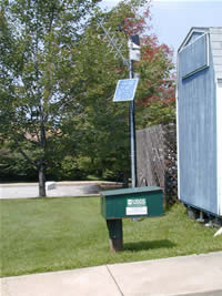
INSTRUMENTATION.--Data collection platform with 60-minute recording interval. Satellite telemetry at station.
DATUM.--Elevation of land surface is 1,222.6 ft above North American Vertical Datum of 1988. Land surface elevation is from survey. Measuring point: Top of casing, 1.80 ft above land-surface datum.
REMARKS.--Daily maximum, minimum, and mean water levels are available from the District Office.
PERIOD OF RECORD.--September 2001 to current year.
COOPERATION.--Funding for the operation of this station is provided by the Pennsylvania Department of Environmental Protection and the U.S. Geological Survey.
Summary of all available data for this site
Instantaneous-data availability statement
