PROVISIONAL DATA SUBJECT TO REVISION
Click to hidestation-specific text
Summary of all available data for this site
Instantaneous-data availability statement

| Most Recent Instantaneous Value Jul 3 | Min (1940) | 25th percen- tile | Median | Mean | 75th percen- tile | Max (2002) |
|---|---|---|---|---|---|---|
| -- unavailable -- | 0.80 | 0.8 | 2.2 | 4.1 | 9.3 | 9.32 |
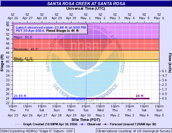
Gage height, feet |
||
|
||
Stream water level elevation above NAVD 1988, in feet |
||
|
||
![]() U.S. Department of the Interior |
U.S. Geological Survey
U.S. Department of the Interior |
U.S. Geological Survey
Title: USGS Current Conditions for the Nation
URL:
Page Contact Information: California Water Data Support Team
Page Last Modified: 2025-07-03 21:16:30 EDT
2 1.21 nadww01