PROVISIONAL DATA SUBJECT TO REVISION
Click to hidestation-specific text
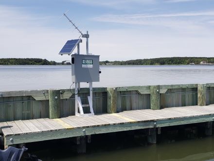
LOCATION.--Lat 38°41'24.7", long 75°04'42.7", Sussex County, DE, Hydrologic Unit 02040303, on northeast
   shore of Rehoboth Bay, south of Head of Bay Cove, at Dewey Beach, and at west end of Rodney Avenue,
   and on end of pier at Pier Point Marina.
DRAINAGE AREA.--Not determined.
PERIOD OF RECORD.--April 1985 to September 1997; November 2000 to current year.
GAGE.--Water-stage recorder.  Datum of gage is 0.00 ft above North American Vertical Datum of 1988.
   Prior to October 1, 2014, at datum 0.78 ft higher (0.00 ft above NGVD29). Prior to May 21, 2019,
   at site 2,300 ft northwest at datums noted.
REMARKS.--This a tidal station. Discharge is not determined at this location. U.S. Geological
   Survey satellite data-collection platform at station.
EXTREMES OUTSIDE OF PERIOD OF RECORD.--Storm of March 1962 reached a stage of 7.0 ft, prior site and datum,
   from floodmark.
EXTREMES FOR PERIOD OF RECORD.--Maximum elevation, 5.34 ft, October 29, 2012, at site and datum then
   in use; minimum elevation, unknown.
COOPERATION.--Funding for the operation of this station is provided by the Delaware Geological Survey,
   and the Delaware Department of Transportation.
CRITICAL LEVELS.--Top of bulkhead; 2.43 ft NAVD88, information provided by U.S. Geological Survey.
Note - In order to convert historic water level data stored in NGVD29 datum to the current NAVD88 datum users must apply the known -0.78 ft datum shift, as calculated for this location using VERTCON.
Summary of all available data for this site
Instantaneous-data availability statement
