USGS 01531908 Towanda Creek near Franklindale, PA

PROVISIONAL DATA SUBJECT TO REVISION

Click to hidestation-specific text
Funding for this site is provided by:


Station gage image
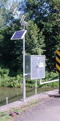
STATION.--01531908 TOWANDA CREEK NEAR FRANKLINDALE, PA
LOCATION.--Lat 41`41'52", long 76`34'43", Bradford County, Hydrologic Unit 02050106, located upstream right wingwall of steel grate truss bridge near Franklin Township Volunteer Fire Department
DRAINAGE AREA.--112 square miles.
PERIOD OF RECORD.--July 2010 to current year.
GAGE.--Water-stage recorder and crest-stage gage. Datum of gage is 900 ft above National Geodetic Vertical Datum of 1929, from topographic map. Satellite telemetry at station.
COOPERATION.--Station established and maintained by the U.S. Geological Survey. Funding for the operation of this station is provided by Repsol Oil & Gas USA, LLC.
This station managed by the PAWSC Williamsport Field Office.

Available Parameters Available Period
  
2010-07-31  2024-04-20
2010-07-30  2024-04-20


 (7)
 

  -- or --


Summary of all available data for this site
Instantaneous-data availability statement


Discharge, cubic feet per second

Most recent instantaneous value: 171 04-20-2024   07:15 EDT
Graph of  Discharge, cubic feet per second

Add up to 2 more sites and replot for "Discharge, cubic feet per second"

?


Create presentation-quality / stand-alone graph.   Subscribe to WaterAlert      

See this graph on the Monitoring Location Pages


Daily discharge, cubic feet per second -- statistics for Apr 20 based on 13 water years of record more
Min
(2012)
25th
percen-
tile
Most Recent
Instantaneous
Value Apr 20
Median Mean 75th
percen-
tile
Max
(2019)
16.2 102 171 200 282 337 1070


Gage height, feet

Most recent instantaneous value: 3.93 04-20-2024   07:15 EDT
Graph of  Gage height, feet

Add up to 2 more sites and replot for "Gage height, feet"

?


Create presentation-quality / stand-alone graph.   Subscribe to WaterAlert      

See this graph on the Monitoring Location Pages