PROVISIONAL DATA SUBJECT TO REVISION
Click to hidestation-specific text
Funding for this site is provided by:
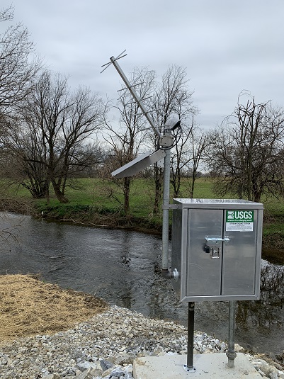 STATION.--01576767 PEQUEA CREEK NEAR RONKS, PA
LOCATION.--Lat 40`00'33", long 76`09'44", Lancaster County, Hydrologic Unit, 02050306, at left bank on downstream side of South Ronks Road, 2.9 mi downstream from Watson Run and 1.2 mi south of Ronks, PA.
DRAINAGE AREA.--70 square miles.
PERIOD OF RECORD.--October 2012 to current year.
GAGE.--Water-stage recorder and crest-stage gage. Datum of gage is 320.1 ft above North American Vertical Datum of 1988 (NAVD88) (GNSS survey). Prior to September 24, 2024, the datum of gage was erroneously reported as 325 ft above National Geodetic Vertical Datum of 1929 or NAVD8 depending on source. Satellite telemetry at station.
COOPERATION.--Station established and maintained by the U.S. Geological Survey in cooperation with the U.S. Environmental Protection Agency.
GAGE HEIGHTS OF IMPORTANCE.--Data transmitter operational limit = 17.4 feet.
Summary of all available data for this site
Instantaneous-data availability statement