USGS 01581830 GRAVE RUN NEAR BECKLEYSVILLE, MD

PROVISIONAL DATA SUBJECT TO REVISION

Click to hidestation-specific text

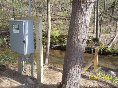
LOCATION.--Lat 39°39'17.3", long 76°46'51.3",
   Baltimore County, MD, Hydrologic Unit 02060003, on left bank off of Gunpowder Road (formerly Upper  
   Beckleysville Road), 1,000 ft upstream from Prettyboy Reservoir, 0.9 mi north of Beckleysville, 
   and 1.7 mi downstream from Indian Run.
DRAINAGE AREA.--7.68 mi2.
PERIOD OF RECORD.--March 2000 to current year.
GAGE.--Water-stage recorder and crest-stage gage. Datum of gage is 525.34 ft above North American 
   Vertical Datum of 1988. Previously operated as a low-flow partial-record station during water
   years 1977-82 at same location.
REMARKS.--U.S. Geological Survey satellite data-collection platform at station.
EXTREMES FOR PERIOD OF RECORD.--Maximum discharge, 2,230 ft3/s, July 23, 2018, gage height, 7.85 ft;
   minimum discharge, 0.54 ft3/s, Aug. 21-23, 2002.
COOPERATION.--Funding for the operation of this station is provided by the Baltimore City Department
   of Public Works.
This station managed by the MD-DE-DC Water Science Center Baltimore office.

Available Parameters Available Period
  
2000-03-25  2024-03-28
2007-10-01  2024-03-28


 (7)
 

  -- or --


Summary of all available data for this site
Instantaneous-data availability statement


Discharge, cubic feet per second

Most recent instantaneous value: 12.2 03-28-2024   15:00 EDT
Graph of  Discharge, cubic feet per second

Add up to 2 more sites and replot for "Discharge, cubic feet per second"

?


Create presentation-quality / stand-alone graph.   Subscribe to WaterAlert      

See this graph on the Monitoring Location Pages


Daily discharge, cubic feet per second -- statistics for Mar 28 based on 24 water years of record more
Min
(2002)
25th
percen-
tile
Median Most Recent
Instantaneous
Value Mar 28
Mean 75th
percen-
tile
Max
(2005)
5.57 8.8 12 12.2 14 16 58.0


Gage height, feet

Most recent instantaneous value: -0.24 03-28-2024   15:00 EDT
Graph of  Gage height, feet

Add up to 2 more sites and replot for "Gage height, feet"

?


Create presentation-quality / stand-alone graph.   Subscribe to WaterAlert      

See this graph on the Monitoring Location Pages