LOCATION.--Lat 40°34'44", long
73°57'56" referenced to North American Datum of 1927,
Kings County, NY, Hydrologic Unit 02030202, at west side of
Brighton 3rd Street, south of Oceanview Avenue, Coney
Island.
WELL CHARACTERISTICS.--Depth 25 ft. Upper casing
diameter 2 in; top of first opening 15 ft, bottom of last
opening 20 ft.
DATUM.--Land-surface datum is 9 ft above National
Geodetic Vertical Datum of 1929. Measuring point: Top of
casing, 0.32 ft below land-surface datum, 8.68 ft above
land-surface datum, Oct. 1, 2002 to present.
PERIOD OF RECORD.--October 2002 to April 2015, July 2024
to current year.
GAGE.--Periodic
manual measurements by USGS personnel.
REMARKS.--Replaced well K3250.1 in October 2002 near
same location. Water level affected by tidal fluctuation.
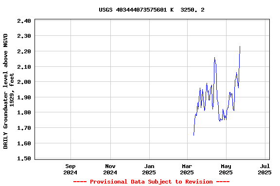
EXTREMES FOR PERIOD OF RECORD.--Highest water level
measured, 2.70 ft above NGVD of 1929, Sept. 29, 2004; lowest
measured, 0.82 ft above NGVD of 1929, Sept. 2, 2004.
 Site Information
 WaterAlert – get an
email or text (SMS) alert based on your chosen threshold.
WaterAlert – get an
email or text (SMS) alert based on your chosen threshold. Station image