LOCATION.--Lat 40°38'27", long
73°53'52" referenced to North American Datum of 1927,
Kings County, NY, Hydrologic Unit 02030202, at south side of
Avenue J, 120 ft east of Rockaway Avenue, Canarsie.
WELL CHARACTERISTICS.--Depth 25 ft. Upper casing
diameter 2 in; top of first opening 15 ft, bottom of last
opening 25 ft.
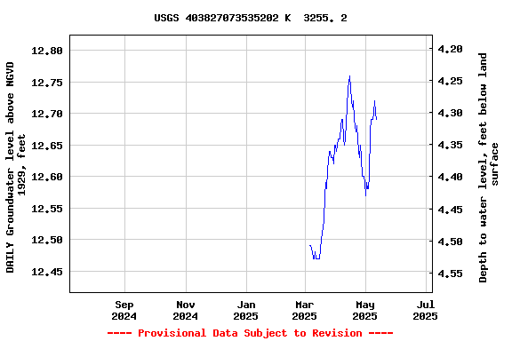
DATUM.--Land-surface datum is 17 ft above National
Geodetic Vertical Datum of 1929. Measuring point: Top of
casing, 0.42 ft below land-surface datum, 16.58 ft above
land-surface datum, Jun. 24, 1998 to present.
PERIOD OF RECORD.--July 1998 to April 2015, June 2024 to
current year.
GAGE.--Periodic manual measurements by USGS
personnel.
REMARKS.--Replaced well K3255.1 in June 1998 near same
location.
EXTREMES FOR PERIOD OF RECORD.--Highest water level
measured, 4.89 ft above NGVD of 1929, Mar. 19, 2010; lowest
measured, 2.71 ft above NGVD of 1929, Jan. 28, 2002.
 Site Information
 WaterAlert – get an
email or text (SMS) alert based on your chosen threshold.
WaterAlert – get an
email or text (SMS) alert based on your chosen threshold. Station image