LOCATION.--Lat 40°40'36", long
73°58'40" referenced to North American Datum of 1927,
Kings County, NY, Hydrologic Unit 02030201, at north side of
Lincoln Place, 120 ft east of 6th Avenue, easternmost well,
Park Slope.
WELL CHARACTERISTICS.--Depth 70 ft. Upper casing
diameter 2 in; top of first opening 65 ft, bottom of last
opening 70 ft.
DATUM.--Land-surface datum is 60.6 ft above National
Geodetic Vertical Datum of 1929. Measuring point: Top of
coupling, 1.6 ft below land-surface datum, 59.0 ft above
land-surface datum, Mar. 2, 1984 to present.
PERIOD OF RECORD.--March 1984 to October 1985, June 1988
to April 2015, July 2024 to current year.
GAGE.--Periodic manual measurements by USGS
personnel.
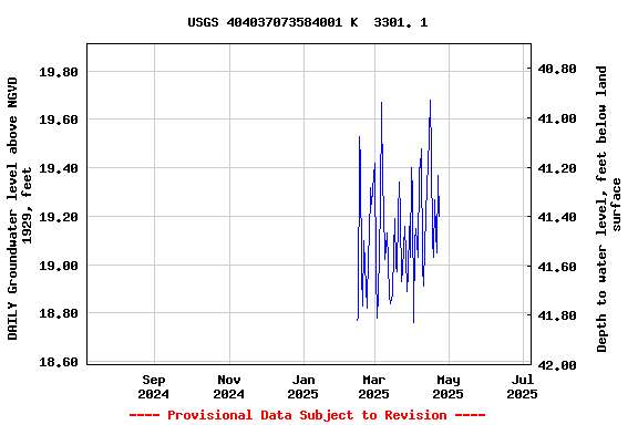
EXTREMES FOR PERIOD OF RECORD.--Highest water level
measured, 20.16 ft above NGVD of 1929, June 28, 1984; lowest
measured, 12.96 ft above NGVD of 1929, June 18, 2002.
 Site Information
 WaterAlert – get an
email or text (SMS) alert based on your chosen threshold.
WaterAlert – get an
email or text (SMS) alert based on your chosen threshold. Station image