LOCATION.--Lat 40°47'32.6", long
73°48'27.1" referenced to North American Datum of
1983, Queens County, NY, Hydrologic Unit 02030201, at north
side of 11th Avenue, 82 ft west of 154th Street,
Whitestone.
WELL CHARACTERISTICS.--Depth 215 ft. Upper casing
diameter 4 in; top of first opening 165 ft, bottom of last
opening 185 ft.
DATUM.--Land-surface datum is 20.8 ft above National
Geodetic Vertical Datum of 1929. Measuring point: Top of
casing, 0.04 ft below land-surface datum, 20.76 ft above
land-surface datum, Jul. 27, 1995 to present.
PERIOD OF RECORD.--March 1996 to April 2015, April 2024
to current year.
GAGE.--Periodic manual measurements by USGS
personnel.
REMARKS.--Water level affected by tidal
fluctuation.
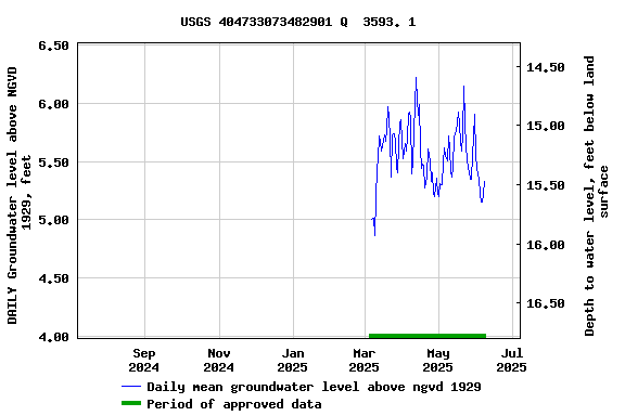
EXTREMES FOR PERIOD OF RECORD.--Highest water level
measured, 7.08 ft above NGVD of 1929, Apr. 21, 2008; lowest
measured, 2.63 ft above NGVD of 1929, Aug. 28, 2003.
 Site Information
 WaterAlert – get an
email or text (SMS) alert based on your chosen threshold.
WaterAlert – get an
email or text (SMS) alert based on your chosen threshold. Station image