LOCATION.--Lat 40°41'43", long
73°48'27" referenced to North American Datum of 1927,
Queens County, NY, Hydrologic Unit 02030202, at east side of
Liverpool Street, 54 ft north of 101st Avenue, Jamaica.
WELL CHARACTERISTICS.--Depth 65 ft. Upper casing
diameter 2 in; top of first opening 60 ft, bottom of last
opening 65 ft.
DATUM.--Land-surface datum is 41.6 ft above National
Geodetic Vertical Datum of 1929. Measuring point: Top of
coupling, 0.59 ft below land-surface datum, 41.01 ft above
land-surface datum, Mar. 2, 1984 to present.
PERIOD OF RECORD.--March 1984 to August 2014, March 2024
to current year. Unpublished records for March 1984 to
September 1987 are available in files of the U.S. Geological
Survey.
GAGE.--Water level recorder installed May 1998 to
September 2013. Periodic manual measurements by USGS
personnel.
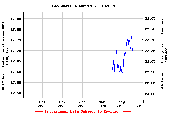
EXTREMES FOR PERIOD OF RECORD.--Highest water level
recorded, 21.16 ft above NGVD of 1929, Sept. 15, 2011; lowest
measured, 7.28 ft above NGVD of 1929, Mar. 2, 1984.
 Site Information
 WaterAlert – get an
email or text (SMS) alert based on your chosen threshold.
WaterAlert – get an
email or text (SMS) alert based on your chosen threshold. Station image