USGS 01480400 Birch Run near Wagontown, PA

PROVISIONAL DATA SUBJECT TO REVISION

Click to hidestation-specific text
Funding for this site is provided by:


Station gage imageSTATION.--01480400 BIRCH RUN NEAR WAGONTOWN, PA
LOCATION.--Lat 40`01'38", long 75`50'43", Chester County, Hydrologic Unit 02040205, on right bank 15 ft upstream from SR 4005, 0.2 mi upstream of mouth, 0.6 mi downstream from Chambers Lake, and 1.1 mi northwest of Wagontown.
DRAINAGE AREA.--4.55 square miles.
PERIOD OF RECORD.--February 1995 to current year.
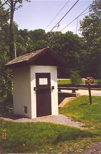
GAGE.--Water-stage recorder, water-quality monitor, crest-stage gage, and concrete control. Elevation of gage is 505.81 ft above North American Vertical Datum of 1988. Satellite telemetry at station.
COOPERATION.--Station established and maintained by the U.S. Geological Survey. Funding for the operation of this station is provided by Chester County Water Resources Authority.
REMARKS.--Flow regulated by Chambers Lake (station 01480399) 0.6 mi upstream. Satellite and landline telemetry at station.
GAGE HEIGHTS OF IMPORTANCE.-
Supplied by USGS: Data transmitter operational limit - 11.6 ft, approx 9.5 ft, Lion's Head Road low point at gage.
Supplied by NWS: No flood stage has been determined for this station.
This station managed by the PAWSC Downingtown Field Office.

Available Parameters Available Period
  
2007-10-01  2024-03-29
2007-10-01  2024-03-29
2007-10-01  2024-03-29


 (7)
 

  -- or --


Summary of all available data for this site
Instantaneous-data availability statement


Temperature, water, degrees Celsius

Most recent instantaneous value: 9.8 03-29-2024   10:45 EDT
Graph of  Temperature, water, degrees Celsius

Add up to 2 more sites and replot for "Temperature, water, degrees Celsius"

?


Create presentation-quality / stand-alone graph.   Subscribe to WaterAlert      

See this graph on the Monitoring Location Pages


Discharge, cubic feet per second

Most recent instantaneous value: 12.5 03-29-2024   10:45 EDT
Graph of  Discharge, cubic feet per second

Add up to 2 more sites and replot for "Discharge, cubic feet per second"

?


Create presentation-quality / stand-alone graph.   Subscribe to WaterAlert      

See this graph on the Monitoring Location Pages


Daily discharge, cubic feet per second -- statistics for Mar 29 based on 28 water years of record more
Min
(2012)
25th
percen-
tile
Median Mean 75th
percen-
tile
Most Recent
Instantaneous
Value Mar 29
Max
(2005)
1.40 5.4 7.3 11 12 12.5 50.6


Gage height, feet

Most recent instantaneous value: 2.58 03-29-2024   10:45 EDT
Graph of  Gage height, feet

Add up to 2 more sites and replot for "Gage height, feet"

?


Create presentation-quality / stand-alone graph.   Subscribe to WaterAlert      

See this graph on the Monitoring Location Pages