USGS 03026480 East Branch Clarion River near Clermont, PA

PROVISIONAL DATA SUBJECT TO REVISION

Click to hidestation-specific text
Funding for this site is provided by:


Station gage image
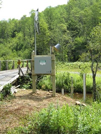
STATION.--03026480 EAST BRANCH CLARION RIVER NEAR CLERMONT, PA
LOCATION.--Lat 41`38'38.6", long 78`31'53.2", McKean County, Hydrologic Unit 05010005, on right bank 1,290 ft downstream from Buck Run, 3.8 mi southwest of Clermont, and 7.9 mi upstream from East Branch of Clarion River Lake Dam.
DRAINAGE AREA.--8.32 square miles.
PERIOD OF RECORD.--July 2012 to current year.
GAGE.--Water-stage recorder, water-quality monitor and crest-stage gage. Datum of gage is 1,763 ft above North American Vertical Datum of 1988. U.S. Army Corps of Engineers satellite telemetry at station.
COOPERATION.--Station established and maintained by the U.S. Geological Survey. Funding for the operation of this station is provided by the U.S. Army Corps of Engineers, Pittsburgh District.
This station managed by the PAWSC Williamsport Field Office.

Available Parameters Available Period
  
2012-10-01  2024-03-28
2012-10-01  2024-03-28
2012-10-01  2024-03-28


 (7)
 

  -- or --


Summary of all available data for this site
Instantaneous-data availability statement


Temperature, water, degrees Celsius

Most recent instantaneous value: 10.5 03-28-2024   14:45 EDT
Graph of  Temperature, water, degrees Celsius

Add up to 2 more sites and replot for "Temperature, water, degrees Celsius"

?


Create presentation-quality / stand-alone graph.   Subscribe to WaterAlert      

See this graph on the Monitoring Location Pages


Discharge, cubic feet per second

Most recent instantaneous value: 13.2 03-28-2024   14:45 EDT
Graph of  Discharge, cubic feet per second

Add up to 2 more sites and replot for "Discharge, cubic feet per second"

?


Create presentation-quality / stand-alone graph.   Subscribe to WaterAlert      

See this graph on the Monitoring Location Pages


Daily discharge, cubic feet per second -- statistics for Mar 28 based on 11 water years of record more
Min
(2019)
25th
percen-
tile
Most Recent
Instantaneous
Value Mar 28
Median Mean 75th
percen-
tile
Max
(2020)
10.7 13 13.2 17 20 26 39.9


Gage height, feet

Most recent instantaneous value: 2.47 03-28-2024   14:45 EDT
Graph of  Gage height, feet

Add up to 2 more sites and replot for "Gage height, feet"

?


Create presentation-quality / stand-alone graph.   Subscribe to WaterAlert      

See this graph on the Monitoring Location Pages