PROVISIONAL DATA SUBJECT TO REVISION
Click to hidestation-specific text
Funding for this site is provided by:
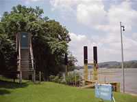 STATION.--03075071 MONONGAHELA RIVER BELOW LOCK
& DAM 3 AT ELIZABETH, PA
STATION.--03075071 MONONGAHELA RIVER BELOW LOCK
& DAM 3 AT ELIZABETH, PALOCATION.--Lat 40`15'55", long 79`53'52", Allegheny County, Hydrologic Unit 05020005.
DRAINAGE AREA.--5,339 square miles.
PERIOD OF RECORD.--June 2010 to current year.
GAGE.--Water-stage recorder and concrete dam control. Datum of gage is 709.16 ft above North American Vertical Datum of 1988 (from benchmark). Prior to February 20, 2024, the datum of gage was reported as 709.7 ft above National Geodetic Vertical Datum of 1929 (NGVD29) and prior to February 22, 2021, erroneously reported as 730 ft above NGVD29 depending on source. Satellite telemetry at site.
COOPERATION.--Funding for the operation of this station is provided by the U.S. Army Corps of Engineers, Pittsburgh District, and the U.S. Geological Survey.
Summary of all available data for this site
Instantaneous-data availability statement
