PROVISIONAL DATA SUBJECT TO REVISION
Click to hidestation-specific text
 STATION.--03085500 CHARTIERS CREEK AT CARNEGIE,
PA
STATION.--03085500 CHARTIERS CREEK AT CARNEGIE,
PALOCATION.--Lat 40`24'02", long 80`05'48", Allegheny County, Hydrologic Unit 05030101, on left bank 100 ft downstream from Hammond Street bridge, 0.3 mi downstream from Robinson Run, 0.8 mi upstream from Campbells Run, and 8.9 mi upstream from mouth.
DRAINAGE AREA.--257 square miles.
PERIOD OF RECORD.--October 1919 to September 1933, October 1940 to current year. Published as "at Crafton" October 1971 to September 1975. Monthly discharge only for some periods, published in WSP 1305. June 1915 to September 1919 (gage heights and discharge measurements only) in reports of Water Supply Commission of Pennsylvania.
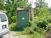
GAGE.--Water-stage recorder and concrete weir control. Datum of gage is 754.9 ft. above North American Vertical Datum of 1988 . Prior to Dec. 15, 1931, nonrecording gage at site 0.5 mi downstream at different datum. Jan. 8, 1932 to Sept. 30, 1933, non-recording gage at site 1.0 mi downstream at different datum. Nov. 20, 1940 to Aug. 18, 1967, water-stage recorder at site 400 ft upstream at datum 1.00 ft higher. Oct. 1, 1971 to Sept. 30, 1975, non-recording gage at site 4.6 mi downstream, at datum 29.46 ft lower. Prior to January 8, 2024, the datum of gage was reported as 755.45 ft above National Geodetic Vertical Datum of 1929. Satellite telemetry at station.
COOPERATION.--Station established and maintained by the U.S. Geological Survey. Funding for the operation of this station is provided by the U.S. Army Corps of Engineers, Pittsburgh District, the Pennsylvania Department of Environmental Protection and the U.S. Geological Survey.
REMARKS.--Some regulations at low flow by mine drainage, reservoirs, and industrial usage above station.
GAGE HEIGHTS OF IMPORTANCE.-
Supplied by NWS:Action stage-14 ft; Flood stage-20 ft; Moderate flood stage-21 ft; Major flood stage-23 ft.
| The 15-minute precipitation data for this station are temporary and will only be displayed for 120 days. Time series of 1-hour or cumulative daily values will NOT be available for retrieval following the 120-day display period. Although the instrumentation is calibrated at least once a year, the temporary classification means that documented routine inspections and other quality assurance measures are not performed that would make the data acceptable for archival, retrieval, or future use in general scientific or interpretive studies. |
Summary of all available data for this site
Instantaneous-data availability statement

